


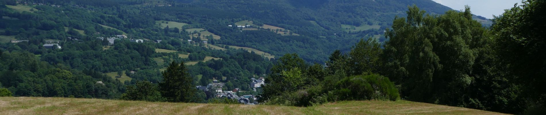
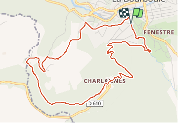
CHARLANNES PAR FOHET AVEC RETOUR ANCIEN FUNICULAIRE

walrou63
User

Length
6.4 km

Max alt
1154 m

Uphill gradient
318 m
Km-Effort
10.6 km

Min alt
854 m

Downhill gradient
315 m
Boucle
Yes
Creation date :
2019-07-09 16:21:31.743
Updated on :
2019-07-09 16:46:08.27
2h00
Difficulty : Very easy

FREE GPS app for hiking
 SityTrail
IGN / Geographical institutes
SityTrail Plus
The world is yours!
About
Trail On foot of 6.4 km to be discovered at Auvergne-Rhône-Alpes, Puy-de-Dôme, La Bourboule. This trail is proposed by walrou63.
Photos


Positioning
Country:
France
Region :
Auvergne-Rhône-Alpes
Department/Province :
Puy-de-Dôme
Municipality :
La Bourboule
Location:
Unknown
Start:(Dec)
Start:(UTM)
479633 ; 5048092 (31T) N.
Comments